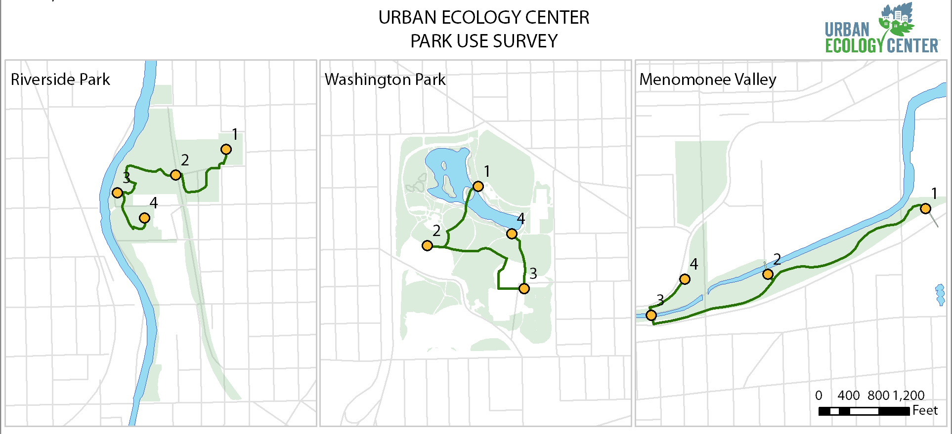
Data is collected for 10 minutes at four predetermined assessment locations at each park. The survey routes vary in length due to the topography of the parks we manage, and the observation locations are placed in areas where the Center has a direct influence. See the maps below for our survey routes and assessment locations.
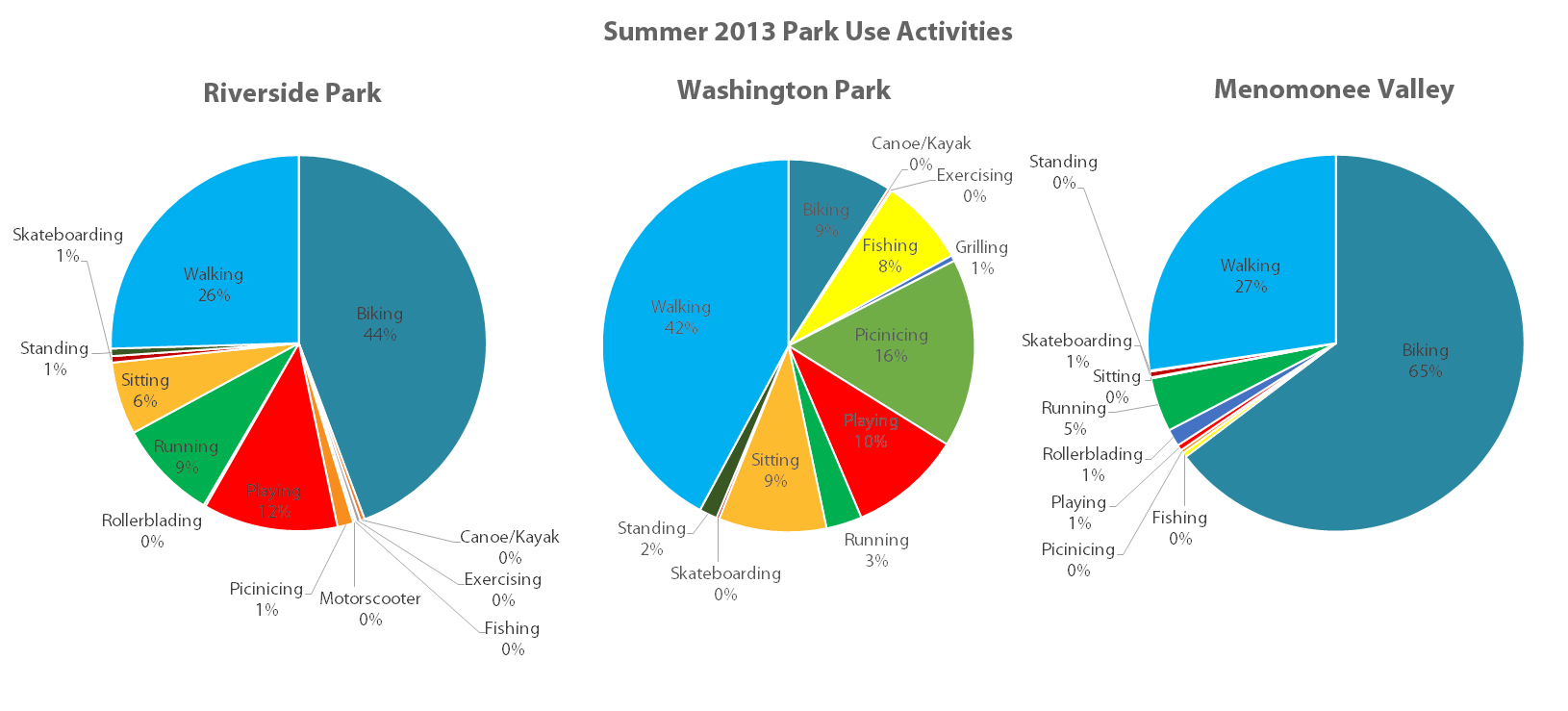
From this park use survey, we found some interesting results! For example, the activities people engage in are different at each park. In Three Bridges Park and Riverside Park, the predominant use of the park is biking (mostly commuters on the Oak Leaf and Hank Aaron State Trail), whereas walking is the most common activity in Washington Park. Another interesting thing we discovered from the summer park use survey is that there is more diversity in activities at Washington Park (as demonstrated in the charts below). Community members at Washington Park engage in playing, fishing, and picnic-ing more so than at the other parks. (Click on the image to make it larger to view!)
We are still in the process of crunching numbers for summer time park attendance. Our estimates will be based on weather, time of day, and day of the week.
Want to get involved with this project?
We could use your help in collecting this important data! There are 21 surveys that need to be completed each season (we create a random sample of survey periods based on the day of week and time of day). We would love to create a core group of park use survey volunteers for each Urban Ecology Center branch. If this sounds like something you are interested in, but have never been trained, please contact Anne Reis at This email address is being protected from spambots. You need JavaScript enabled to view it.. This is a great way to get outside, take a hike, and conduct important research for the Urban Ecology Center!


